UN General Assembly Votes to Phase Out Traditional Mercator Map in Favor of Accurate World Proportions
The United Nations General Assembly has voted, with a 164-state majority, in favor of a resolution calling for the gradual phase-out of the traditional Mercator map projection—used since 1569—to adopt more accurate cartographic representations of true landmasses. Led by Togo and backed by the African Union, the initiative passed despite opposition from the United States and abstentions from six member states.
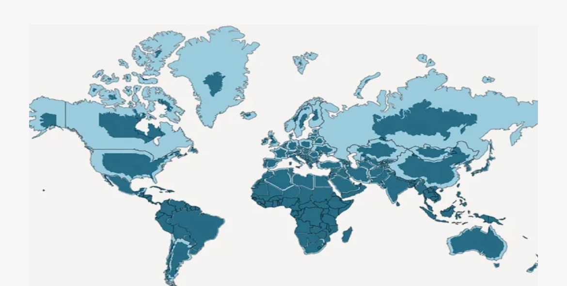
Originally created by Flemish cartographer Gerardus Mercator to assist nautical navigation, the projection distorts land sizes by enlarging regions as they move further from the Equator. Under this system, Greenland appears roughly equal in size to Africa, whereas the African continent is actually nearly 14 times larger.
Togo stated that these distorted representations have generated long-term educational, cultural, and geopolitical impacts by underrepresenting the global presence of Africa and the Global South. Although UN General Assembly resolutions are non-binding, the move is expected to influence educational curricula and digital mapping applications. France announced its support by transitioning to the Eckert IV projection, while a meeting is scheduled in Lomé for early next year to coordinate implementation strategies with UNESCO and technology companies.